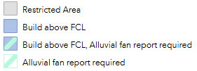
The “simplified floodplain mapping” layer has combined the mapped components of the floodplain bylaw to produce a simplified version. The “simplified floodplain mapping” layer compiles information into one area (polygon) that displays what you need to know about the floodplain bylaw for that location. It only covers the areas where mapping was recently updated. Previous mapping is still available using the Floodplain Mapping under the Hazards layer.
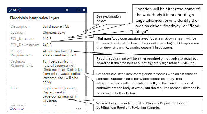
If you click through the information in the property pop-up, you will see the “simplified floodplain mapping” layer information (see example below).

Under Description in the property pop-up, there are four descriptions:
